Construction analysis – 3D model


| Supplier | Paul Metzger |
| Service provision | At the Supplier, Online, At the Buyer |
| Service location |
Bauanalyse - München
|
| Service duration | 30 minutes |
| Payment | Free initial consultation |
| Service in |
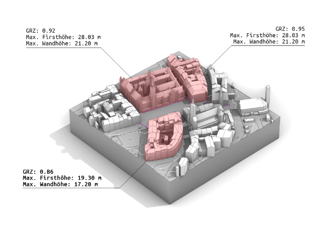
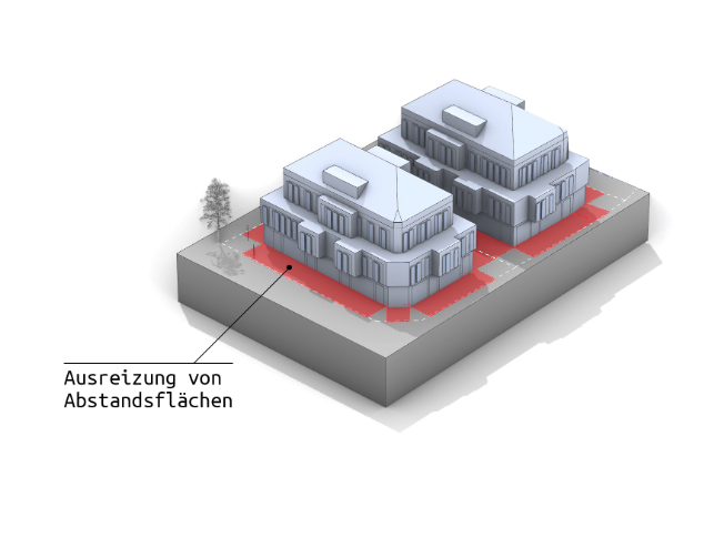
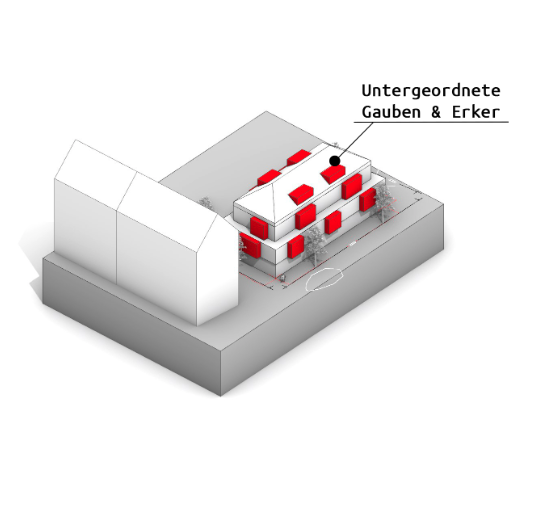
Form follows automation: the future of construction is automated. Do you work with properties on a daily basis as an architect, private property owner, real estate agent or project developer? We have the solution for you: we analyse properties using official geodata and evaluate them automatically. In the first step, we obtain all the necessary official geodata that together form the perfect data basis for your construction project: Digital terrain model (topography) of your property (DGM1) 3D building data of the neighbourhood (LOD2) Official cadastral plan (ALKIS) We calculate the new-build potential of your property! Depending on its size, shape and urban context, your property has a certain number of square metres of living or usable space. This parameter is crucial for the value of your property. That is why we calculate all the important key figures for you, such as living space, floor space ratio, cubic capacity and much more. All important key figures. E.g. floor space ratio (GRZ) living space (according to WoFlV) gross floor area (BGF), and much more. Comprehensive neighbourhood analysis in accordance with §34 BauGB (‘insertion requirement’) If your property is not within the scope of a development plan, §34 BauGB applies. Accordingly, the construction project must ‘blend in’ with the ‘character’ of the surrounding area. We create a clear data basis for a clear interpretation. Determining the degree of building utilisation based on official geodata Calculation of building volumes, floor areas, ridge and wall heights, and much more Application of the neighbourhood parameters to the potential new building Maximum utilisation and exact calculation of the so-called distance rule (Art. 6 BayBO) At the beginning of each construction project, the distances to the neighbouring boundaries are usually calculated. Our software calculates these distances in such a way that as much building mass as possible can be accommodated on the property. Exact calculation of distances in relation to the terrain Consideration of recesses, dormers and oriels Calculation according to the amended Bavarian building regulations (BayBO) Additional maximisation of space through so-called ‘subordinate components’ According to the Bavarian building regulations (Art. 6, 5a BayBO), components up to a certain size can protrude in front of the facade without violating the above-mentioned distances. We dimension dormers and oriels in such a way that they are considered ‘subordinate’. This allows the building to maintain the minimum distance to the neighbour's property - at the same time, living and usable space are further maximised. Automatic calculation of subordinate oriels and dormers Additional maximisation of living and usable space Clear facade design to make the architecture understandable for laymen

